 ar
ar bg
bg hr
hr cs
cs da
da nl
nl fi
fi fr
fr de
de el
el hi
hi it
it ko
ko no
no pl
pl pt
pt ro
ro ru
ru es
es sv
sv tl
tl iw
iw id
id lv
lv lt
lt sr
sr sk
sk sl
sl uk
uk vi
vi et
et hu
hu th
th tr
tr fa
fa ms
ms hy
hy ka
ka ur
ur bn
bn mn
mn ta
ta kk
kk uz
uz ku
ku
tiltmeter use
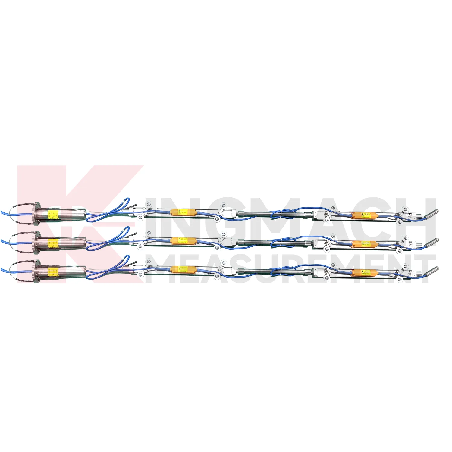
The JMQJ-7915ATS vertical in-place inclinometer system gives Kingmach tiltmeter use a multi-point downhole monitoring method. The system consists of a multi-point tandem inclinometer string and an orifice acquisition module. Multiple MEMS inclination sensors are electrically connected through a single cable inside the borehole, while universal joints and connecting rods arrange measuring points according to design spacing. The system can divide sensors into up to four independent communication groups, uses automatic temperature compensation, and includes electronic identifiers for automatic recognition and intelligent calculation. Published specifications include dual-axis +/-90 degrees tilt range, 0.001 degree resolution, 0.01 degree accuracy, DC 9V to 24V operating voltage, power consumption below 0.2W, single-wire uplink communication at 1200 bps, -30 degrees Celsius to +70 degrees Celsius operating temperature, 0.35 m guide wheel spacing, about 0.8 kg weight, and IP68 protection.

Application of tiltmeter use
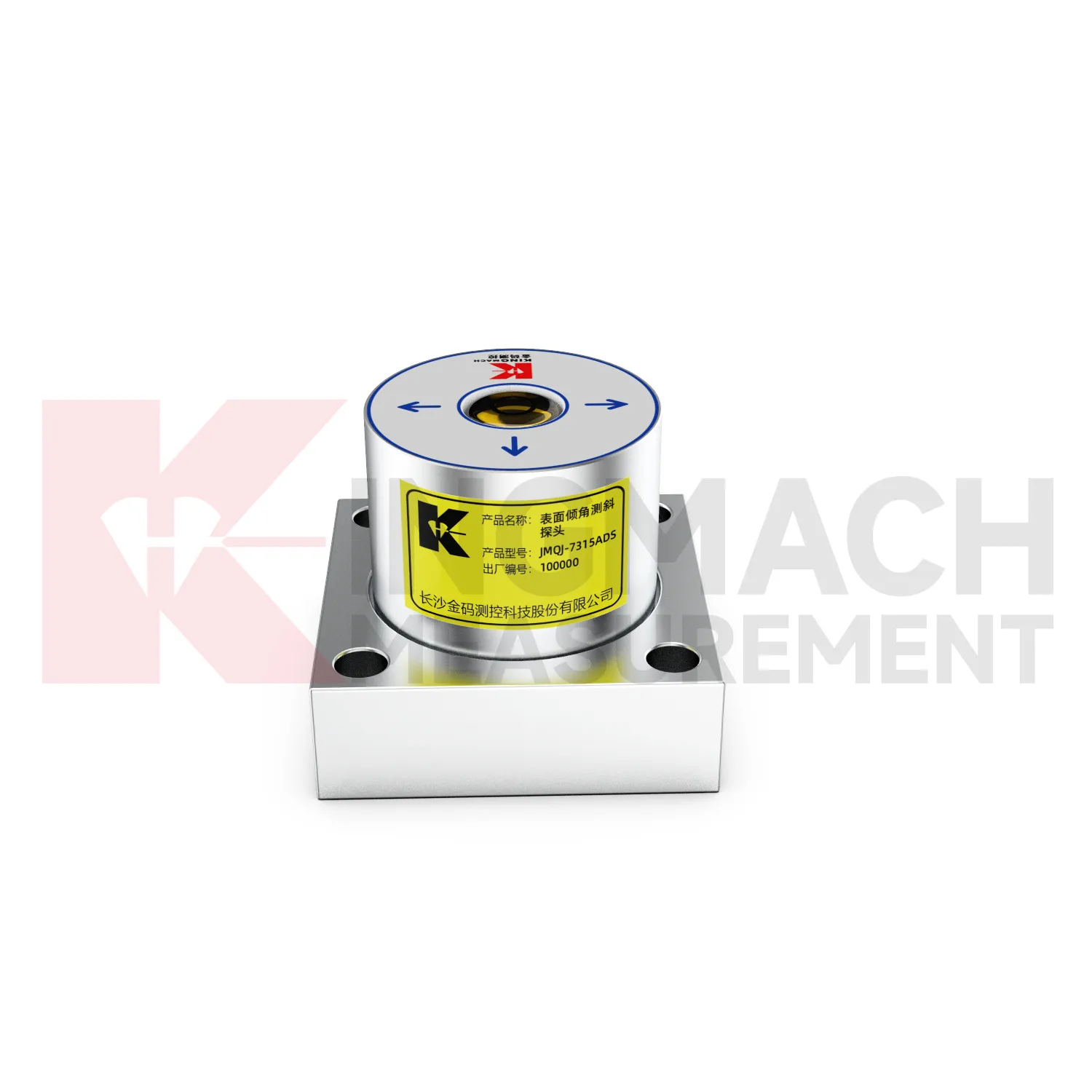
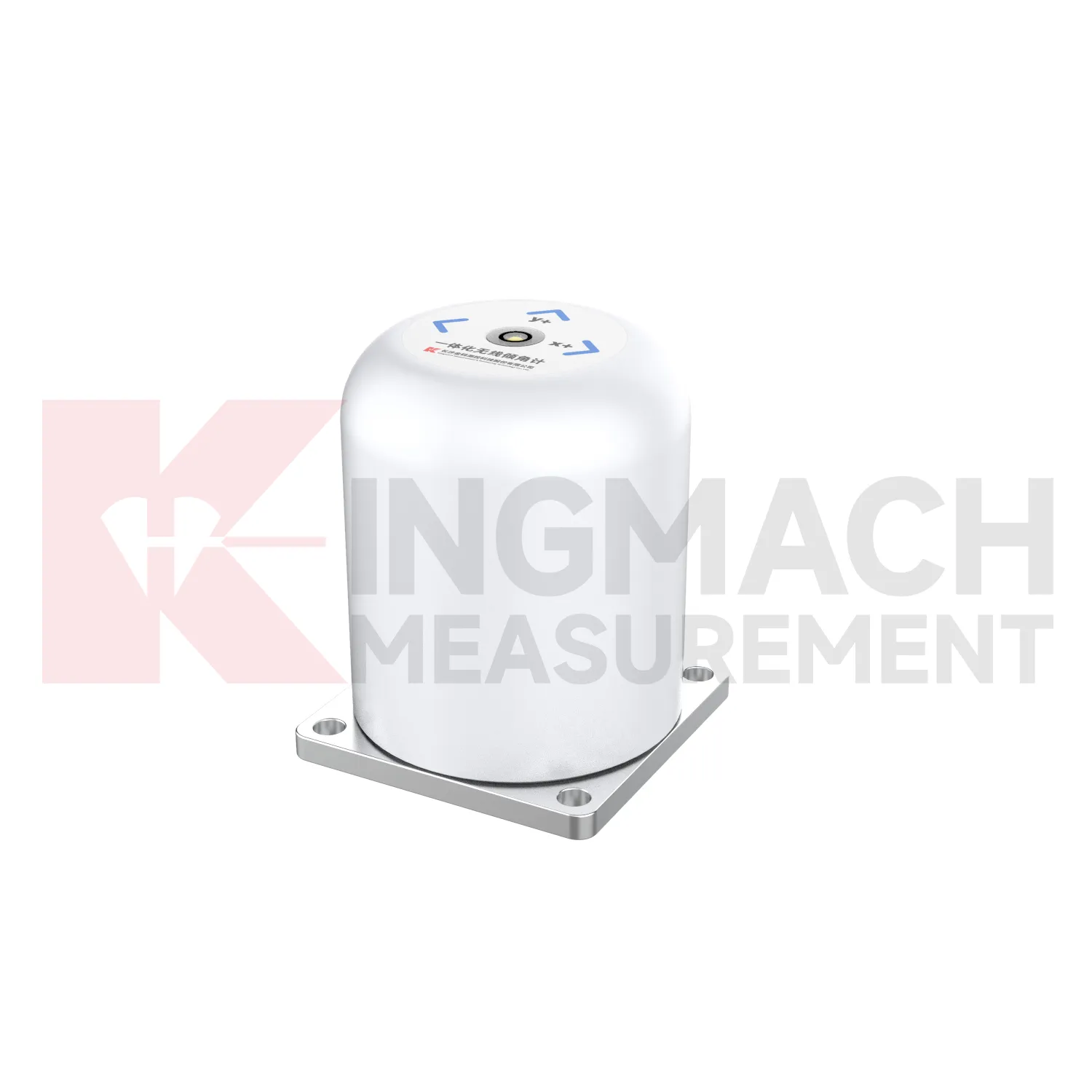
Building monitoring uses tiltmeter use when column lines, basement walls, adjacent structures, or old buildings near construction activity need tilt records. JMQJ-7315ADS can measure angular change relative to the horizontal plane, and JMQJ-7315RTU can provide wireless reporting for remote or occupied sites. The data should be checked against foundation settlement, crack observations, groundwater changes, nearby excavation, demolition, pile driving, and load changes. Building tilt is often small, so installation quality matters. The mounting surface must be firm, the sensor axis must be recorded, and the baseline should be taken after the sensor has stabilized. For old or damaged buildings, clear point labels and photographs are important because many parties may review the same data during a long project.
The future of tiltmeter use
Multi-point borehole monitoring will continue to expand the role of tiltmeter use. JMQJ-7915ATS already connects multiple in-place inclinometer sensors through a single cable, with grouped communication, universal joints, connecting rods, electronic identifiers, and an orifice acquisition module. This type of system turns a borehole into a depth-based deformation profile rather than a single surface observation. Future improvements will likely focus on easier factory configuration, clearer point identification, lower power operation, and faster data review. Slopes, foundation pits, dams, embankments, and underground projects benefit from knowing where movement is happening inside the ground. Depth-specific tilt data can help teams move from general warnings to targeted inspection and reinforcement planning.
Care & Maintenance of tiltmeter use
Cable and communication care is essential for tiltmeter use. JMQJ-7315ADS uses RS485 digital output, JMQJ-7315RTU uses wireless 4G transmission, JMZX-7100L uses Bluetooth for field reading, and JMZX-4QH supports RS485 uplink communication. Each path has different maintenance needs. Wired systems need cable protection, terminal checks, address records, grounding review, and cabinet sealing. Wireless units need antenna checks, signal review, upload status, and battery records. Bluetooth field instruments need reading-device pairing and data download discipline. When a channel drops out, inspect power, communication settings, connectors, and recent site work before replacing the sensor. A communication fault should not be mistaken for a real tilt event.
Kingmach tiltmeter use
Kingmach tiltmeter use help turn difficult-to-observe deformation into repeatable engineering evidence. Hidden parts of structures are often the hardest to judge: deep soil, buried retaining systems, bridge substructures, railway bases, foundation pit walls, and underground construction zones. Tilt measurement gives engineers a way to see angular change before visible damage becomes obvious. The product category is used in bridges, tunnels, slopes, buildings, foundation pits, geological hazard areas, railways, dams, embankments, port engineering, and other structural scenarios. The monitoring record should connect each sensor to a drawing location, axis label, baseline date, power source, communication path, and related construction activity. Without that context, even a precise angle may be hard to interpret. With it, tilt data can support timely inspection and measured engineering decisions.
FAQ
Q: How often should tiltmeter use be inspected?
A: Inspection frequency depends on risk, access, construction stage, and deformation speed; active excavation or storm periods often need closer review.Q: What maintenance is needed for wireless tilt units?
A: Check battery status, antenna condition, upload timing, enclosure seals, point label, and platform channel naming.Q: What causes false tilt changes?
A: Loose mounting, disturbed cables, water entry, temperature effects, power faults, channel mistakes, or inconsistent manual reading can affect the record.Q: How should replacement be handled?
A: Record old and new model, serial number, range, baseline, reason, date, axis direction, channel name, and first stable value after replacement.Q: What makes tilt data useful over many years?
A: Consistent point naming, stable baselines, clear installation photos, protected hardware, visible maintenance records, and comparison with related site data.
Reviews
Matthew Garcia
Instrumentation cables are durable and perform well even in harsh environments. Will definitely order again.
David Wilson
We purchased displacement transducers and settlement sensors, and the quality exceeded our expectations. Easy installation and reliable performance.
Latest Inquiries
To protect the privacy of our buyers, only public service email domains like Gmail, Yahoo, and MSN will be displayed. Additionally, only a limited portion of the inquiry content will be shown.
Amelia***@gmail.comSingapore
Hello, I am looking for visualization software for monitoring system data analysis. Please let me kn...
Emma***@gmail.comCanada
Dear Sir/Madam, we are interested in displacement transducers and settlement sensors for a geotechni...